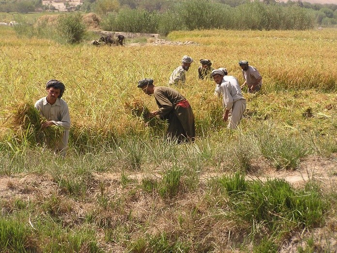
Landell Mills develops methodology for monitoring cropping intensity changes in irrigation schemes using remote sensing satellite technology
Landell Mills has developed a methodology to assess the status of vegetation within individual canal command areas of the Panj-Amu River Basin (P-ARB) in Afghanistan and to compare this with other irrigation areas in the basin. The report explores the use of Moderate Resolution Imaging Spectroradiometer (MODIS) 250m resolution Normalized Difference Vegetation Index (NDVI) to record vegetation levels in mid-August.
The MODIS NDVI is effective in independently verifying reported increases in irrigated areas and improved water allocation within command areas, and could be used as a tool to prioritize investments in irrigation areas (i.e. for irrigation schemes with low NVDI which could be increased with investment). It is freely available (https://earthexplorer.usgs.gov).
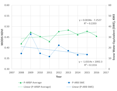
Evolution of Late August NDVI: 2008 - 2016
The average NDVI index for the whole of the P-ARB was compared with the annual Snow Water Equivalent (SWE) calculated by the Ministry of Energy and Water (MEW) Water Resources Department. The Mann-Kendall statistical analysis indicates that the P-ARB SWE was stable between 2008 and 2015 with a confidence level of 73%, while the NDVI is probably increasing with a confidence level of 95%.
This supports the hypothesis that crop productivity has improved over the basin, because of better water management within the irrigation areas, and thus supports the P-ARBP final report conclusions, developed by Landell Mills, that EU investment has had a beneficial impact on cropping intensity.
The methodology was developed as part of the EU-funded Panj-Amu River Basin Programme (P-ARBP), which was implemented from 2009-2017.